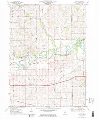
1971 Map of Ridott
USGS Topo · Published 1974About this map
The Pecatonica River meanders across this northern Illinois landscape, creating the prominent Sumner Island and a complex floodplain just north of Ridott. This 1970s survey captures a rural landscape defined by its agricultural grid and the Illinois Central Gulf Railroad, which runs through the village and the stop at Evarts. Local history is preserved in the numerous named schools and cemeteries that dot the countryside, such as Brick School and Ridott Center Cem.
Find a feature on this map
56 named features on this map. Tap any name to fly to it.
Don’t see what you’re looking for? This feature index may not catch every label — zoom into the map to look around manually.
Map Details
Editions of this 1971 Ridott Map
2 editions found

Other maps of this area

1922 · Oregon
USGS Topo · 1:62,500

1924 · Oregon
USGS Topo · 1:62,500

1932 · Pecatonica
USGS Topo · 1:62,500

1936 · Pecatonica
USGS Topo · 1:62,500

1939 · Freeport
USGS Topo · 1:48,000

1942 · Forreston
USGS Topo · 1:62,500

1944 · Freeport
USGS Topo · 1:62,500

1945 · Forreston
USGS Topo · 1:62,500

1954 · Rockford
USGS Topo · 1:250,000

1955 · Rockford
USGS Topo · 1:250,000