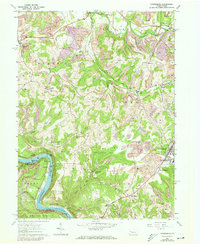
1963 Map of Rimersburg
USGS Topo · Published 1973About this map
The Allegheny River carves a deep horseshoe bend at the southwestern corner of this quadrangle, framing the settlement of Hillville and the riverbank site of Sarah Furnace. This 1960s landscape, photorevised in the early 1970s, reveals a region defined by its industrial extraction and rural outposts. Extensive Strip Mine operations are visible across the Toby and Madison townships, contrasting with established communities like Rimersburg and Sligo.
Find a feature on this map
40 named features on this map. Tap any name to fly to it.
Don’t see what you’re looking for? This feature index may not catch every label — zoom into the map to look around manually.
Map Details
Editions of this 1963 Rimersburg Map
3 editions found
Other maps of this area

1900 · Kittanning
USGS Topo · 1:62,500

1901 · Rural Valley
USGS Topo · 1:62,500

1902 · Kittanning
USGS Topo · 1:62,500

1903 · Rural Valley
USGS Topo · 1:62,500

1906 · Clarion
USGS Topo · 1:62,500

1907 · Clarion
USGS Topo · 1:62,500

1907 · Foxburg
USGS Topo · 1:62,500

1908 · Foxburg
USGS Topo · 1:62,500

1953 · Pittsburgh
USGS Topo · 1:250,000

1954 · Pittsburgh
USGS Topo · 1:250,000