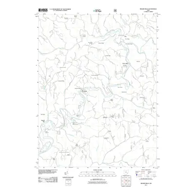
2011 Map of Rinard Mills
USGS Topo · Published 2011About this map
The Little Muskingum River meanders through this portion of Washington County, anchoring a landscape defined by sharp ridges and deep hollows. Small agricultural settlements like Rinard Mills and Bloomfield sit alongside the river and its many tributaries, such as Witten Run and Wilson Run. This area preserves a high density of rural burial grounds, including the Ludlow Catholic Cemetery and German Cemetery, which serve as vital markers for family historians and genealogists studying the early Catholic and immigrant lineages of the region.
Find a feature on this map
79 named features on this map. Tap any name to fly to it.
Don’t see what you’re looking for? This feature index may not catch every label — zoom into the map to look around manually.
Map Details
Editions of this 2011 Rinard Mills Map
This is the sole edition of this map. No revisions or reprints were ever made.
Other maps of this area

1903 · Macksburg
USGS Topo · 1:62,500

1904 · Marietta
USGS Topo · 1:62,500

1905 · New Matamoras
USGS Topo · 1:62,500

1905 · Macksburg
USGS Topo · 1:62,500

1906 · Saint Marys
USGS Topo · 1:62,500

1924 · St Marys
USGS Topo · 1:62,500

1924 · New Matamoras
USGS Topo · 1:62,500

1924 · Marietta
USGS Topo · 1:62,500

1926 · New Matamoras
USGS Topo · 1:62,500

1927 · Marietta
USGS Topo · 1:62,500