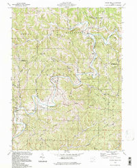
1994 Map of Rinard Mills
USGS Topo · Published 1998About this map
The Little Muskingum River carves a winding path through this portion of the Wayne National Forest, where steep ridges and deep hollows dictate the layout of rural life. Small settlements like Rinard Mills and Hohman anchor the community, while the landscape is dotted with family-named ridges and numerous Gas Wells, reflecting the region's long-standing connection to natural resource extraction. The area's spiritual and genealogical history is well-preserved in country congregations such as Muskingum Valley Ch and Mt Hope Ch, often accompanied by their respective cemeteries like Mt Hope Cem.
Find a feature on this map
61 named features on this map. Tap any name to fly to it.
Don’t see what you’re looking for? This feature index may not catch every label — zoom into the map to look around manually.
Map Details
Editions of this 1994 Rinard Mills Map
This is the sole edition of this map. No revisions or reprints were ever made.
Other maps of this area

1903 · Macksburg
USGS Topo · 1:62,500

1904 · Marietta
USGS Topo · 1:62,500

1905 · New Matamoras
USGS Topo · 1:62,500

1905 · Macksburg
USGS Topo · 1:62,500

1906 · Saint Marys
USGS Topo · 1:62,500

1924 · St Marys
USGS Topo · 1:62,500

1924 · New Matamoras
USGS Topo · 1:62,500

1924 · Marietta
USGS Topo · 1:62,500

1926 · New Matamoras
USGS Topo · 1:62,500

1927 · Marietta
USGS Topo · 1:62,500