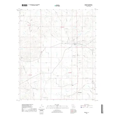
2018 Map of Ringgold
USGS Topo · Published 2018About this map
Ringgold serves as the primary hub for this portion of Bienville Parish, characterized by a transition from the town center to the dense hydrological network of the surrounding bottomlands. The town is bounded by the winding course of Mill Cr and Grand Bayou, which dominate the central landscape. For those researching family history, the map provides an unusually dense distribution of burial grounds, including the Tooke Cem and Shehee Cem to the northwest, and the Wimberly Cem and Stafford Cem near the southern boundary. Further south, the settlements of Tullis and Woodardville mark the rural landscape along the Red Br and Wimberly Br. The intricate naming of small tributaries like Tennyson Cr, Sanders Cr, and Carter Br illustrates how the local terrain is deeply carved by water, defining the placement of rural roads and historical property boundaries.
Find a feature on this map
82 named features on this map. Tap any name to fly to it.
Don’t see what you’re looking for? This feature index may not catch every label — zoom into the map to look around manually.
Map Details
Editions of this 2018 Ringgold Map
This is the sole edition of this map. No revisions or reprints were ever made.
Other maps of this area

1941 · East Point
USGS Topo · 1:31,680

1941 · Bossier Point
USGS Topo · 1:31,680

1947 · Ringgold
USGS Topo · 1:62,500

1947 · Ashland
USGS Topo · 1:62,500

1948 · Coushatta
USGS Topo · 1:62,500

1948 · Jamestown
USGS Topo · 1:62,500

1949 · Jamestown
USGS Topo · 1:62,500

1955 · Shreveport
USGS Topo · 1:250,000

1956 · Shreveport
USGS Topo · 1:250,000

1956 · Ringgold
USGS Topo · 1:62,500