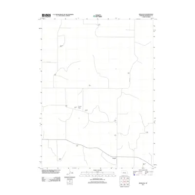
2011 Map of Ringgold
USGS Topo · Published 2011About this map
Ringgold and its surrounding ranchlands in McPherson County define the landscape of this 2011 survey. The settlement pattern is characterized by widely dispersed family holdings, reflecting the enduring cattle-ranching heritage of the Nebraska Sandhills. These properties, such as the J Miller Ranch, W Winters Ranch, and Keesler Ranch, are often accessed by a simple network of local roads like Cemetery Rd and Ringgold Rd. The infrastructure for managing these large tracts is evident in features like the Trumbull Ranch Airport, which serves the Trumbull Ranch and Leeds Ranch area. This map provides a look at a sparsely populated region where the ranch remains the primary social and economic unit, maintained across generations as seen in the density of family-named landmarks.
Find a feature on this map
20 named features on this map. Tap any name to fly to it.
Don’t see what you’re looking for? This feature index may not catch every label — zoom into the map to look around manually.
Map Details
Editions of this 2011 Ringgold Map
This is the sole edition of this map. No revisions or reprints were ever made.
Other maps of this area

1899 · North Platte
USGS Topo · 1:125,000

1902 · North Platte
USGS Topo · 1:125,000

1949 · Cody Lake
USGS Topo · 1:62,500

1951 · Tryon
USGS Topo · 1:62,500

1951 · Cody Lake
USGS Topo · 1:62,500

1954 · North Platte
USGS Topo · 1:250,000

1956 · North Platte
USGS Topo · 1:250,000

1957 · North Platte
USGS Topo · 1:250,000

1967 · North Platte
USGS Topo · 1:250,000

1972 · Stapleton NW
USGS Topo · 1:24,000