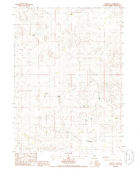
1985 Map of Ringgold
USGS Topo · Published 1986About this map
The small community of Ringgold and its surrounding cattle country define this mid-1980s landscape in McPherson County. Based on 1982 aerial photography, the survey reveals a ranching-dependent economy where large family holdings are the primary landmarks. From the J Miller Ranch in the north down to the Kugler Ranch in the southeast, these named properties show the enduring structure of Nebraska's Sandhills ranching tradition. The presence of a Cem near the center of the sheet suggests an earlier locus of settlement or family burial grounds, while the scattering of windmills and small water bodies like Lake Ranch point to the critical role of groundwater in this environment. The sparse road network and lack of dense town centers illustrate the characteristic isolation of the region during the late twentieth century.
Find a feature on this map
13 named features on this map. Tap any name to fly to it.
Don’t see what you’re looking for? This feature index may not catch every label — zoom into the map to look around manually.
Map Details
Editions of this 1985 Ringgold Map
This is the sole edition of this map. No revisions or reprints were ever made.
Other maps of this area

1899 · North Platte
USGS Topo · 1:125,000

1902 · North Platte
USGS Topo · 1:125,000

1949 · Cody Lake
USGS Topo · 1:62,500

1951 · Tryon
USGS Topo · 1:62,500

1951 · Cody Lake
USGS Topo · 1:62,500

1954 · North Platte
USGS Topo · 1:250,000

1956 · North Platte
USGS Topo · 1:250,000

1957 · North Platte
USGS Topo · 1:250,000

1967 · North Platte
USGS Topo · 1:250,000

1972 · Stapleton NW
USGS Topo · 1:24,000