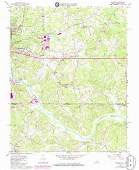
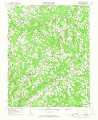
1965 Map of Ringgold
USGS Topo · Published 1985About this map
The Dan River meanders across the border of Pittsylvania County, Virginia, and Caswell County, North Carolina, anchoring a landscape of agricultural tradition and mid-century industrial growth. This 1965 survey, updated through 1985, reveals the expansion of the Danville Industrial Development Area and the Danville Municipal Airport, while maintaining the rural character of communities like Ringgold and Mountain Hill. The map is particularly useful for genealogists, as it documents numerous rural congregations and resting places, such as Wesley Chapel, Mt Zion Ch, and the Floral Hill Mem Garden.
Find a feature on this map
53 named features on this map. Tap any name to fly to it.
Don’t see what you’re looking for? This feature index may not catch every label — zoom into the map to look around manually.
Map Details
Editions of this 1965 Ringgold Map
5 editions found

Other maps of this area

1923 · Danville
USGS Topo · 1:48,000

1925 · Danville
USGS Topo · 1:62,500

1952 · Milton
USGS Topo · 1:62,500

1953 · Greensboro
USGS Topo · 1:250,000

1954 · Greensboro
USGS Topo · 1:250,000

1956 · Milton
USGS Topo · 1:62,500

1962 · Greensboro
USGS Topo · 1:250,000

1964 · Mount Hermon
USGS Topo · 1:24,000
1964 · Blairs
USGS Topo · 1:24,000

1965 · Danville
USGS Topo · 1:24,000