
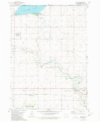
1980 Map of Ringsted
USGS Topo · Published 1980About this map
Ringsted serves as the primary population center in this northern Iowa landscape, where the town layout is clearly defined by its street grid, water tower, and Radio Tower. The surrounding terrain in the townships of Denmark and Armstrong Grove is dominated by a managed agricultural and conservation footprint. The presence of the East Swan Lake State Game Management Area in the northwest corner highlights the region's commitment to wildlife habitat alongside intensive farming.
Find a feature on this map
19 named features on this map. Tap any name to fly to it.
Don’t see what you’re looking for? This feature index may not catch every label — zoom into the map to look around manually.
Map Details
Editions of this 1980 Ringsted Map
This is the sole edition of this map. No revisions or reprints were ever made.
Other maps of this area

1954 · Fairmont
USGS Topo · 1:250,000

1958 · Fairmont
USGS Topo · 1:250,000

1980 · Fenton
USGS Topo · 1:24,000

1980 · Depew
USGS Topo · 1:24,000

1980 · Seneca
USGS Topo · 1:24,000

1980 · Armstrong
USGS Topo · 1:24,000

1980 · Ingham Lake
USGS Topo · 1:24,000

1980 · Gruver
USGS Topo · 1:24,000

1980 · Graettinger East
USGS Topo · 1:24,000
1980 · Dolliver
USGS Topo · 1:24,000