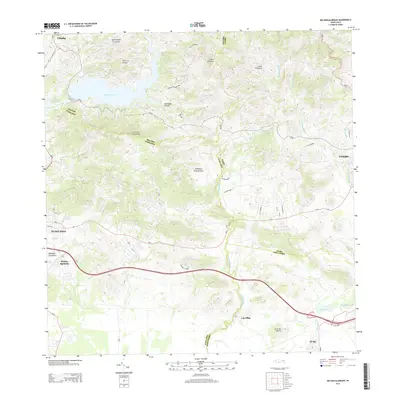
2013 Map of Rio Descalabrado
USGS Topo · Published 2013About this map
Lago Toa Vaca and Lago Guayabal dominate the northern terrain of this interior region, where the municipal boundaries of Villalba, Juana Díaz, and Coamo meet. The landscape is defined by the descent from the central mountains toward the southern coast, carved by the Río Descalabrado and Río Coamo. The 2013 survey illustrates a sophisticated network of local infrastructure, from the developed residential clusters at Piedra Aguzada and Las Ollas to the winding mountain routes like PR-150 and the Carretera Mun Cerro Gordo. Prominent peaks such as Cerro La Coroza and Cerro del Muerto provide clear landmarks within the Cordillera Central foothills. The map reveals the transition from high-elevation peaks like Loma Pelagatos to the agricultural and residential plains near El Ojo, reflecting the modern balance of water resource management and rural settlement.
Find a feature on this map
43 named features on this map. Tap any name to fly to it.
Don’t see what you’re looking for? This feature index may not catch every label — zoom into the map to look around manually.
Map Details
Editions of this 2013 Rio Descalabrado Map
This is the sole edition of this map. No revisions or reprints were ever made.
Other maps of this area

1944 · Santa Isabel
USGS Topo · 1:30,000

1945 · Playa De Ponce
USGS Topo · 1:30,000

1945 · Ponce
USGS Topo · 1:30,000

1945 · Rio Descalabrado
USGS Topo · 1:30,000

1945 · Salinas
USGS Topo · 1:30,000

1946 · Coamo
USGS Topo · 1:30,000

1946 · Barranquitas
USGS Topo · 1:30,000

1946 · Jayuya
USGS Topo · 1:30,000

1946 · Orocovis
USGS Topo · 1:30,000

1947 · Ponce NE
USGS Topo · 1:10,000
Featured Places
- Sector Sierrita, Coamo
- Sector Villa Pote, Santa Isabel
- Sector Magas, Juana Díaz
- Villa Geraldina, Juana Díaz
- Sector Caribe, Coamo