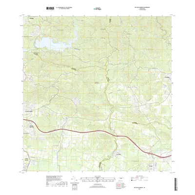
2018 Map of Rio Descalabrado
USGS Topo · Published 2018About this map
Rio Descalabrado winds through a landscape defined by the intersection of mountain peaks and southern coastal plains in the late 2010s. The terrain transitions from the high elevations of Cerro Petronila and Loma Pelagatos in the north toward the flatter agricultural and developed lands near the Caribbean coast. Modern transit is dominated by the Autopista Luis A Ferre, which bisects the quadrangle as it carries traffic between major urban centers.
Find a feature on this map
28 named features on this map. Tap any name to fly to it.
Don’t see what you’re looking for? This feature index may not catch every label — zoom into the map to look around manually.
Map Details
Editions of this 2018 Rio Descalabrado Map
This is the sole edition of this map. No revisions or reprints were ever made.
Other maps of this area

1944 · Santa Isabel
USGS Topo · 1:30,000

1945 · Playa De Ponce
USGS Topo · 1:30,000

1945 · Ponce
USGS Topo · 1:30,000

1945 · Rio Descalabrado
USGS Topo · 1:30,000

1945 · Salinas
USGS Topo · 1:30,000

1946 · Coamo
USGS Topo · 1:30,000

1946 · Barranquitas
USGS Topo · 1:30,000

1946 · Jayuya
USGS Topo · 1:30,000

1946 · Orocovis
USGS Topo · 1:30,000

1947 · Ponce NE
USGS Topo · 1:10,000
Featured Places
- Sector Sierrita, Coamo
- Sector Villa Pote, Santa Isabel
- Sector Magas, Juana Díaz
- Villa Geraldina, Juana Díaz
- Sector Caribe, Coamo