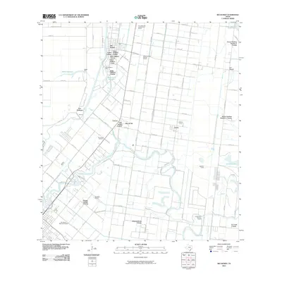
2010 Map of Rio Hondo
USGS Topo · Published 2010About this map
The winding Arroyo Colorado dictates the development of this South Texas landscape, serving as a vital waterway that supports both local irrigation and commerce. Near its banks, Port Harlingen and the city of Rio Hondo anchor a region characterized by a complex network of colonial settlements, including Villa del Sol Colonia, Rancho Grande Colonia, and Arroyo Gardens Number 2 Colonia. These distinct residential clusters reflect the unique land-use patterns of the Rio Grande Valley.
Find a feature on this map
97 named features on this map. Tap any name to fly to it.
Don’t see what you’re looking for? This feature index may not catch every label — zoom into the map to look around manually.
Map Details
Editions of this 2010 Rio Hondo Map
This is the sole edition of this map. No revisions or reprints were ever made.
Other maps of this area

1929 · Rio Hondo
USGS Topo · 1:24,000

1929 · Harlingen
USGS Topo · 1:24,000

1929 · La Paloma
USGS Topo · 1:24,000

1930 · Los Fresnos
USGS Topo · 1:24,000

1930 · Barreda
USGS Topo · 1:24,000

1930 · La Leona
USGS Topo · 1:24,000

1930 · Laguna Atascosa
USGS Topo · 1:24,000

1932 · Combes
USGS Topo · 1:31,680

1932 · Rio Hondo
USGS Topo · 1:31,680

1932 · Harlingen
USGS Topo · 1:31,680