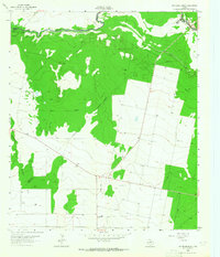
1963 Map of Rio Pecos Ranch
USGS Topo · Published 1965About this map
The Pecos River serves as a critical boundary and lifeline across this arid landscape, where the confluence of three Texas counties—Ward, Reeves, and Pecos—defines the jurisdictional layout. In the early 1960s, the region's economy was driven by the subterranean wealth of the Waha Oil Field and the carefully managed water of the Imperial Ditch and Grand Falls Canal.
Find a feature on this map
18 named features on this map. Tap any name to fly to it.
Don’t see what you’re looking for? This feature index may not catch every label — zoom into the map to look around manually.
Map Details
Editions of this 1963 Rio Pecos Ranch Map
3 editions found
Other maps of this area

1931 · Barstow
USGS Topo · 1:125,000

1954 · Pecos
USGS Topo · 1:250,000

1957 · Pecos
USGS Topo · 1:250,000

1963 · Ligon Ranch
USGS Topo · 1:24,000

1963 · China Lake NE
USGS Topo · 1:24,000

1963 · Rio Pecos Ranch
USGS Topo · 1:24,000

1963 · China Lake
USGS Topo · 1:24,000

1969 · 7 L Ranch
USGS Topo · 1:24,000
1973 · Coyanosa NW
USGS Topo · 1:24,000
1974 · Coyanosa
USGS Topo · 1:24,000