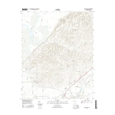
2016 Map of Ripley North
USGS Topo · Published 2016About this map
Ripley and its northern rural outskirts in Lauderdale County are documented here through a dense network of country roads and local water bodies. The terrain transitions from the low-lying wetlands of the Old Bed Forked Deer River and Chisholm Lake in the west to the higher elevations where small communities like Edith, Central, and Arp are situated. This geography is defined by its many small ponds and creeks, including Gum Pond and Cane Creek, alongside family-named landmarks like the Flying I Ranch Airport. Local history is anchored by numerous graveyards such as Mount Pleasant Cem and Pleasant Grove Cem, which serve as vital markers for genealogical research. The map also shows modern infrastructure developments like Cane Cr Lake Number Nine, illustrating how water management has shaped the local landscape over time.
Find a feature on this map
84 named features on this map. Tap any name to fly to it.
Don’t see what you’re looking for? This feature index may not catch every label — zoom into the map to look around manually.
Map Details
Editions of this 2016 Ripley North Map
This is the sole edition of this map. No revisions or reprints were ever made.
Other maps of this area

1939 · Hales Point
USGS Topo · 1:62,500

1939 · Halls
USGS Topo · 1:62,500

1952 · Hales Point
USGS Topo · 1:62,500

1952 · Gates
USGS Topo · 1:24,000

1952 · Fowlkes
USGS Topo · 1:24,000

1956 · Blytheville
USGS Topo · 1:250,000

1959 · Blytheville
USGS Topo · 1:250,000

1961 · Hales Point
USGS Topo · 1:62,500

1961 · Rialto
USGS Topo · 1:62,500

1961 · Halls
USGS Topo · 1:62,500