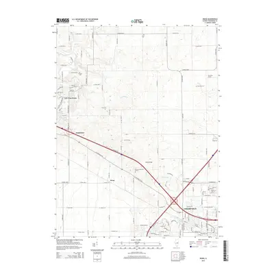
2015 Map of Rising
USGS Topo · Published 2015About this map
The Sangamon River and its tributaries, including Phillippe Cr and the Big Ditch, carve through this central Illinois landscape as it appeared in the mid-2010s. The area is defined by the transition from rural agricultural land to the expanding outskirts of Champaign, marked by the prominent glacial feature of Yankee Ridge. This survey documents the intersection of modern infrastructure and local heritage, with the Mahomet area showing significant development near the Lake of the Woods forest preserve. Genealogists will find several rural burial grounds preserved in the grid of county roads, such as Fisher Cem, Bethlehem Cem, and Jersey Cem. The southern portion of the sheet captures the academic and industrial growth of the region, featuring Parkland Coll and the well-defined residential blocks encroaching upon the historic small settlement of Rising.
Find a feature on this map
101 named features on this map. Tap any name to fly to it.
Don’t see what you’re looking for? This feature index may not catch every label — zoom into the map to look around manually.
Map Details
Editions of this 2015 Rising Map
This is the sole edition of this map. No revisions or reprints were ever made.
Other maps of this area

1906 · Urbana
USGS Topo · 1:62,500

1907 · Mahomet
USGS Topo · 1:62,500

1924 · Paxton
USGS Topo · 1:62,500

1927 · Paxton
USGS Topo · 1:62,500

1928 · Gibson City
USGS Topo · 1:62,500

1949 · Paxton
USGS Topo · 1:62,500

1957 · Urbana
USGS Topo · 1:62,500

1957 · Paxton
USGS Topo · 1:62,500

1957 · Gibson City
USGS Topo · 1:62,500

1957 · Urbana
USGS Topo · 1:24,000