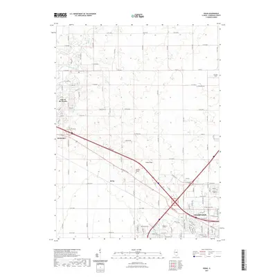
2021 Map of Rising
USGS Topo · Published 2021About this map
Champaign's northwest expansion and the growing community of Mahomet define this landscape during the early 2020s. The transition from established urban infrastructure near Parkland College to the sprawling agricultural tracts of Champaign County is visible as the city's residential streets meet the grid of county roads. The settlement of Rising sits at a critical junction where Bloomington Rd and local rail lines converge, illustrating the historic transit corridors that have long connected these prairie townships.
Find a feature on this map
95 named features on this map. Tap any name to fly to it.
Don’t see what you’re looking for? This feature index may not catch every label — zoom into the map to look around manually.
Map Details
Editions of this 2021 Rising Map
This is the sole edition of this map. No revisions or reprints were ever made.
Other maps of this area

1906 · Urbana
USGS Topo · 1:62,500

1907 · Mahomet
USGS Topo · 1:62,500

1924 · Paxton
USGS Topo · 1:62,500

1927 · Paxton
USGS Topo · 1:62,500

1928 · Gibson City
USGS Topo · 1:62,500

1949 · Paxton
USGS Topo · 1:62,500

1957 · Urbana
USGS Topo · 1:62,500

1957 · Paxton
USGS Topo · 1:62,500

1957 · Gibson City
USGS Topo · 1:62,500

1957 · Urbana
USGS Topo · 1:24,000