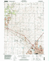
1998 Map of Rising
USGS Topo · Published 2001About this map
The settlement of Rising and the northwestern edge of Champaign anchor this Illinois prairie landscape, where the headwaters of the Sangamon River and the Kaskaskia River flow through a grid of agricultural townships. This survey highlights the rural infrastructure of Hensley and Condit townships before the full onset of modern suburban expansion. The Illinois Central Gulf railroad cuts diagonally across the terrain, serving as a historic transit corridor that shaped local development.
Find a feature on this map
35 named features on this map. Tap any name to fly to it.
Don’t see what you’re looking for? This feature index may not catch every label — zoom into the map to look around manually.
Map Details
Editions of this 1998 Rising Map
This is the sole edition of this map. No revisions or reprints were ever made.
Other maps of this area

1906 · Urbana
USGS Topo · 1:62,500

1907 · Mahomet
USGS Topo · 1:62,500

1924 · Paxton
USGS Topo · 1:62,500

1927 · Paxton
USGS Topo · 1:62,500

1928 · Gibson City
USGS Topo · 1:62,500

1949 · Paxton
USGS Topo · 1:62,500

1957 · Urbana
USGS Topo · 1:62,500

1957 · Paxton
USGS Topo · 1:62,500

1957 · Gibson City
USGS Topo · 1:62,500

1957 · Urbana
USGS Topo · 1:24,000