
1891 Map of Riverside
USGS Topo · Published 1891About this map
Des Plaines River and Chicago River dominate the landscape of western Cook County in this 1891 survey, where the rapid expansion of Chicago’s suburban fringes meets an intricate network of rail and water. The map documents a dense grid of early commuter settlements, including the planned community of Riverside and neighboring Oak Park, established along the heavy rail corridors of the Chicago Burlington and Quincy R. R. and the Chicago & N. W. Ry. A notable hydrological feature is the Ogden Ditch and California Canal, illustrating the era's significant engineering efforts to manage drainage across the low-lying prairie.
Find a feature on this map
66 named features on this map. Tap any name to fly to it.
Don’t see what you’re looking for? This feature index may not catch every label — zoom into the map to look around manually.
Map Details
Editions of this 1891 Riverside Map
This is the sole edition of this map. No revisions or reprints were ever made.
Other maps of this area

1889 · Chicago
USGS Topo · 1:62,500

1890 · Des Plaines
USGS Topo · 1:62,500

1891 · Chicago
USGS Topo · 1:62,500

1892 · Joliet
USGS Topo · 1:62,500

1892 · Calumet
USGS Topo · 1:62,500

1893 · Calumet
USGS Topo · 1:62,500

1893 · Riverside
USGS Topo · 1:62,500

1894 · Des Plaines
USGS Topo · 1:62,500
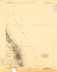
1899 · Evanston
USGS Topo · 1:62,500

1900 · Chicago
USGS Topo · 1:62,500