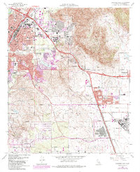
1967 Map of Riverside East
USGS Topo · Published 1984About this map
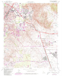
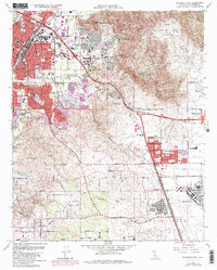
March Air Force Base and its expansive airfield dominate the southeastern landscape of this mid-century survey, flanked by the growing residential communities of Edgemont and Arnold Heights. The map provides a detailed look at the Inland Empire's post-war expansion, showing the urban footprint of Riverside pushing eastward toward the Box Springs Mountains. Educational and research institutions are prominent, including the University of California Riverside and its associated Experiment Station. Transportation infrastructure is a primary theme, with the Riverside Freeway and Escondido Freeway intersecting near the mountains, alongside legacy rail lines like the Atchison Topeka and Santa Fe and the Pacific Electric. From the citrus-growing history implied by the experiment station to the suburban developments at Sunnymead, the map documents a region in rapid transition.
Find a feature on this map
62 named features on this map. Tap any name to fly to it.
Don’t see what you’re looking for? This feature index may not catch every label — zoom into the map to look around manually.
Map Details
Editions of this 1967 Riverside East Map
6 editions found
Other maps of this area

1896 · San Bernardino
USGS Topo · 1:62,500

1898 · San Bernardino
USGS Topo · 1:62,500

1899 · Redlands
USGS Topo · 1:62,500

1901 · Southern California Sheet No. 1
USGS Topo · 1:250,000

1901 · San Bernardino
USGS Topo · 1:62,500

1901 · Redlands
USGS Topo · 1:62,500

1901 · Elsinore
USGS Topo · 1:125,000

1901 · Riverside
USGS Topo · 1:62,500

1904 · Southern California Sheet No. 1
USGS Topo · 1:250,000
1938 · Colton
USGS Topo · 1:31,680