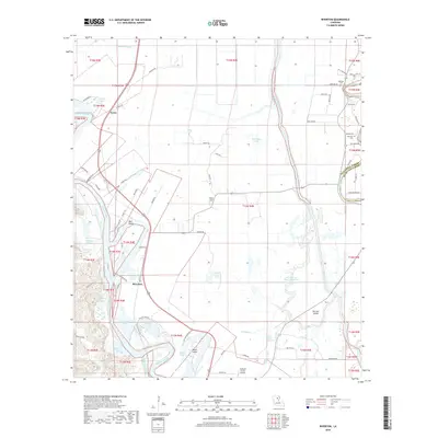
2018 Map of Riverton
USGS Topo · Published 2018About this map
The Ouachita River defines the western landscape of this Caldwell Parish region, winding past settlements such as Riverton and Corey. The area is a complex network of waterways and lowlands, where the Boeuf River and Bayou Lafourche create a riparian environment filled with named features like Horseshoe Lake, Indian Slough, and Hearn Island. The proximity of these rivers to the Caldwell Parish and Richland Parish border underscores the historical importance of water-based boundaries and transport in Northern Louisiana.
Find a feature on this map
79 named features on this map. Tap any name to fly to it.
Don’t see what you’re looking for? This feature index may not catch every label — zoom into the map to look around manually.
Map Details
Editions of this 2018 Riverton Map
This is the sole edition of this map. No revisions or reprints were ever made.
Other maps of this area

1935 · Alto
USGS Topo · 1:62,500

1939 · Fort Necessity
USGS Topo · 1:62,500

1940 · Monroe
USGS Topo · 1:62,500

1940 · Columbia
USGS Topo · 1:62,500

1955 · Jackson
USGS Topo · 1:250,000

1955 · Shreveport
USGS Topo · 1:250,000

1956 · Shreveport
USGS Topo · 1:250,000

1957 · Columbia
USGS Topo · 1:62,500

1957 · Mangham
USGS Topo · 1:62,500

1957 · Monroe South
USGS Topo · 1:62,500