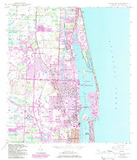
1946 Map of Riviera Beach
USGS Topo · Published 1983About this map
Lake Worth and the Intracoastal Waterway form the central spine of this coastal survey, separating the burgeoning mainland settlements from the barrier islands of the Atlantic coast. The map illustrates a period of significant expansion as modern municipalities like Palm Beach Gardens and North Palm Beach began to take shape alongside established areas like Monet and Lake Park. This era of development is overlaid with 1980s revisions that show the growth of suburban residential patterns between the Florida East Coast and Seaboard rail lines.
Find a feature on this map
32 named features on this map. Tap any name to fly to it.
Don’t see what you’re looking for? This feature index may not catch every label — zoom into the map to look around manually.
Map Details
Editions of this 1946 Riviera Beach Map
4 editions found
Other maps of this area

1945 · Delta
USGS Topo · 1:24,000

1946 · Riviera Beach
USGS Topo · 1:24,000

1946 · Palm Beach Farms
USGS Topo · 1:24,000

1946 · Palm Beach
USGS Topo · 1:24,000

1948 · Rood
USGS Topo · 1:24,000

1948 · Jupiter
USGS Topo · 1:24,000

1949 · Rood
USGS Topo · 1:24,000

1949 · Palm Beach Farms
USGS Topo · 1:24,000

1949 · Riviera Beach
USGS Topo · 1:24,000

1950 · Jupiter
USGS Topo · 1:24,000