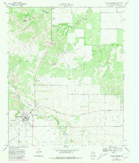
1968 Map of Roaring Springs
USGS Topo · Published 1981About this map
Roaring Springs is depicted in this 1968 study as a focal point of the Rolling Plains, where the Quanah Acme and Pacific railroad intersects the rugged drainage systems of the Caprock escarpment. The landscape is defined by its vital water sources, including Hackberry Spring, Ballard Spring, and the namesake Roaring Springs pool, which supported early cattle ranching and settlement. The transition from agrarian roots to mid-century modernization is evident through features like the Drive-in Theater north of town and Buzz Landing Field.
Find a feature on this map
19 named features on this map. Tap any name to fly to it.
Don’t see what you’re looking for? This feature index may not catch every label — zoom into the map to look around manually.
Map Details
Editions of this 1968 Roaring Springs Map
2 editions found
Other maps of this area

1954 · Lubbock
USGS Topo · 1:250,000

1954 · Plainview
USGS Topo · 1:250,000

1958 · Plainview
USGS Topo · 1:250,000

1966 · Matador
USGS Topo · 1:24,000

1966 · Ballard Camp
USGS Topo · 1:24,000

1967 · Whiteflat
USGS Topo · 1:24,000

1968 · Mac Bain
USGS Topo · 1:24,000

1968 · Roaring Springs
USGS Topo · 1:24,000

1968 · Russellville
USGS Topo · 1:24,000

1968 · Rustler Camp
USGS Topo · 1:24,000