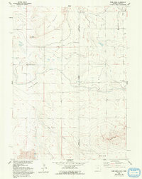
1960 Map of Robb Draw
USGS Topo · Published 1983About this map
Table Mountain and its extensive network of irrigation laterals dominate this High Plains landscape, straddling the Wyoming Nebraska border. The 1960 field-check captures a rural environment defined by the management of water, where the Fort Laramie Canal and numerous drainage branches like Crockett Main Drain support agricultural operations in Crockett Meadows. The small settlement of Janise appears in the northeast corner, serving as a rare cluster of human habitation alongside early educational landmarks like Kiowa Sch and Standard Sch.
Find a feature on this map
27 named features on this map. Tap any name to fly to it.
Don’t see what you’re looking for? This feature index may not catch every label — zoom into the map to look around manually.
Map Details
Editions of this 1960 Robb Draw Map
3 editions found
Other maps of this area

1898 · Scotts Bluff
USGS Topo · 1:125,000

1899 · Goshen Hole
USGS Topo · 1:125,000

1954 · Scottsbluff
USGS Topo · 1:250,000

1954 · Cheyenne
USGS Topo · 1:250,000

1958 · Cheyenne
USGS Topo · 1:250,000

1958 · Scottsbluff
USGS Topo · 1:250,000

1960 · Huntley
USGS Topo · 1:24,000

1960 · Mc Compsey Pass
USGS Topo · 1:24,000

1960 · Lyman
USGS Topo · 1:24,000

1960 · Stegall
USGS Topo · 1:24,000