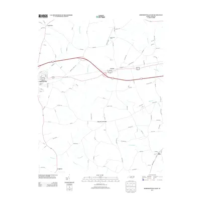
2013 Map of Robersonville East
USGS Topo · Published 2013About this map
The town of Robersonville and the neighboring community of Everetts anchor this eastern North Carolina landscape, where a transition from historic rail-based commerce to modern highway infrastructure is clearly visible. The eastern portion of Robersonville displays a detailed street grid including S Railroad St and Nelson Ave, while Everetts sits just to the east along the same transport corridor. The surrounding terrain is defined by a significant network of wetlands, including Ross Swamp, Huskanaw Swamp, and Collie Swamp, which weave between small settlements like Gold Point and Church Crossroads. This 2013 survey reflects a coastal plain environment where agriculture and aviation meet, evidenced by the Martin County Airport situated north of the highway. Small hamlets like Bear Grass and Congleton dot the lower half of the quadrangle, connected by a web of rural routes such as Everetts Rd and NC-1159.
Find a feature on this map
109 named features on this map. Tap any name to fly to it.
Don’t see what you’re looking for? This feature index may not catch every label — zoom into the map to look around manually.
Map Details
Editions of this 2013 Robersonville East Map
This is the sole edition of this map. No revisions or reprints were ever made.
Other maps of this area

1901 · Parmele
USGS Topo · 1:62,500

1901 · Williamston
USGS Topo · 1:62,500

1902 · Williamston
USGS Topo · 1:62,500

1902 · Parmele
USGS Topo · 1:62,500

1903 · Winterville
USGS Topo · 1:62,500

1903 · Chocowinity
USGS Topo · 1:62,500

1905 · Chocowinity
USGS Topo · 1:62,500

1905 · Winterville
USGS Topo · 1:62,500

1953 · Rocky Mount
USGS Topo · 1:250,000

1954 · Rocky Mount
USGS Topo · 1:250,000