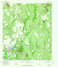
1963 Map of Robert Lee
USGS Topo · Published 1964About this map
Robert Lee serves as the focal point of this Coke County landscape, situated along the north bank of the Colorado River. The town layout in the early 1960s includes the High Sch, Athletic Field, and the Court House, reflecting its role as a regional civic center. The surrounding terrain is characterized by a series of intermittent watercourses such as Machae Creek and Mountain Creek, the latter of which is dammed to form the Mountain Creek Reservoir.
Find a feature on this map
27 named features on this map. Tap any name to fly to it.
Don’t see what you’re looking for? This feature index may not catch every label — zoom into the map to look around manually.
Map Details
Editions of this 1963 Robert Lee Map
2 editions found
Other maps of this area

1891 · Hayrick
USGS Topo · 1:125,000

1893 · Sweetwater
USGS Topo · 1:125,000

1894 · Hayrick
USGS Topo · 1:125,000

1921 · Bronte
USGS Topo · 1:31,680

1921 · Mays School
USGS Topo · 1:31,680

1954 · Big Spring
USGS Topo · 1:250,000

1954 · San Angelo
USGS Topo · 1:250,000

1958 · San Angelo
USGS Topo · 1:250,000

1958 · Big Spring
USGS Topo · 1:250,000
1961 · Shawville
USGS Topo · 1:24,000