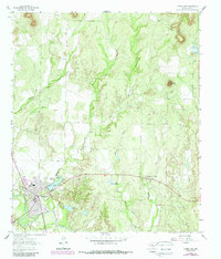
1963 Map of Robert Lee
USGS Topo · Published 1988About this map
The West Texas landscape around Robert Lee is defined by its relationship to the Colorado River and the water management systems of Coke County. This map shows the town at a moment of transition, with the Mountain Creek Reservoir and its spillway prominent north of the river, alongside the Fish Hatchery and Old City Lake. The terrain is marked by the rugged drainage patterns of Machae Creek and Indian Creek, while industrial activity is visible in the form of multiple pipelines and oil production at the Munn Oil Field and Mc Cutchen Oil Field. Genealogists will find the locations of local burial grounds such as Hayrick Cem and Indian Creek Cem particularly valuable for tracing early settlers. The presence of significant Gravel Pits and the Hayrick Mountain landmark further illustrate the physical character and extractive economy of the region during the early 1960s.
Find a feature on this map
19 named features on this map. Tap any name to fly to it.
Don’t see what you’re looking for? This feature index may not catch every label — zoom into the map to look around manually.
Map Details
Editions of this 1963 Robert Lee Map
2 editions found
Other maps of this area

1891 · Hayrick
USGS Topo · 1:125,000

1893 · Sweetwater
USGS Topo · 1:125,000

1894 · Hayrick
USGS Topo · 1:125,000

1921 · Bronte
USGS Topo · 1:31,680

1921 · Mays School
USGS Topo · 1:31,680

1954 · Big Spring
USGS Topo · 1:250,000

1954 · San Angelo
USGS Topo · 1:250,000

1958 · San Angelo
USGS Topo · 1:250,000

1958 · Big Spring
USGS Topo · 1:250,000
1961 · Shawville
USGS Topo · 1:24,000