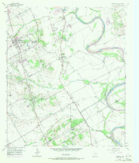
1957 Map of Robinson
USGS Topo · Published 1971About this map
The Brazos River meanders through this landscape south of Waco, defining a fertile valley marked by an extensive system of levees and agricultural drainage ditches. Near the community of Robinson, the map documents a transition from established residential clusters toward the more open, creek-fed ranch lands to the south. An Old Railroad Grade traces a path through the center of the sheet, providing a corridor for early transport between small rural hubs like Downsville and Downs.
Find a feature on this map
30 named features on this map. Tap any name to fly to it.
Don’t see what you’re looking for? This feature index may not catch every label — zoom into the map to look around manually.
Map Details
Editions of this 1957 Robinson Map
4 editions found
Other maps of this area

1892 · Temple
USGS Topo · 1:125,000

1892 · Waco
USGS Topo · 1:125,000

1920 · Waco
USGS Topo · 1:125,000

1920 · Mart
USGS Topo · 1:62,500

1924 · Waco 4-c
USGS Topo · 1:48,000

1931 · Elm Mott
USGS Topo · 1:62,500

1954 · Waco
USGS Topo · 1:250,000

1955 · Waco
USGS Topo · 1:250,000

1957 · Bruceville
USGS Topo · 1:24,000

1957 · Lorena
USGS Topo · 1:24,000