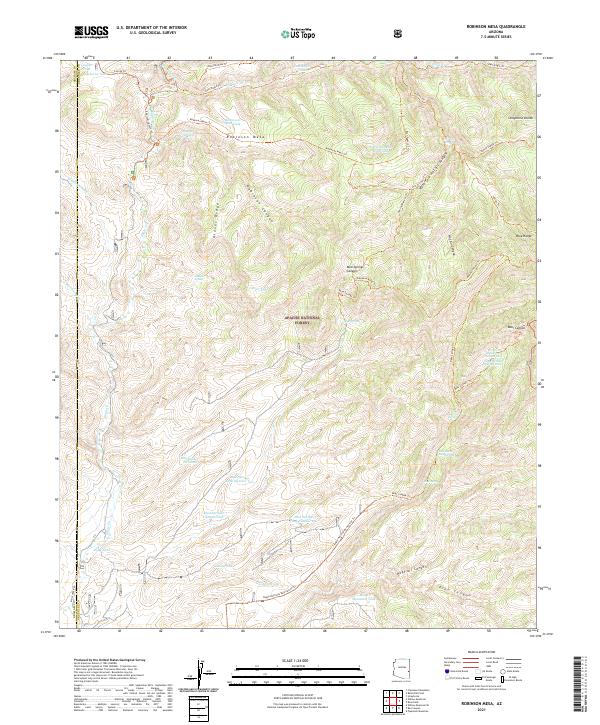
2021 Map of Robinson Mesa
USGS Topo · Published 2021About this map
Apache National Forest dominates this landscape in the mountains of eastern Arizona, where a complex network of canyons and ridges defines the high-altitude terrain. The topography is anchored by Robinson Mesa and Glover Ridge, landforms that separate deep drainage systems like Robinson Canyon and Hot Air Canyon. A clear reliance on seasonal water management is evident through the numerous named water catchments distributed throughout the forest, including Blackwater Pit Tank, East Eagle Tank, and Coyote Tank.
Find a feature on this map
71 named features on this map. Tap any name to fly to it.
Don’t see what you’re looking for? This feature index may not catch every label — zoom into the map to look around manually.
Map Details
Editions of this 2021 Robinson Mesa Map
This is the sole edition of this map. No revisions or reprints were ever made.
Other maps of this area

1913 · Morenci
USGS Topo · 1:125,000

1915 · Morenci
USGS Topo · 1:125,000

1922 · Nutrioso
USGS Topo · 1:125,000

1954 · Clifton
USGS Topo · 1:250,000

1957 · Clifton
USGS Topo · 1:250,000

1958 · Clifton
USGS Topo · 1:250,000

1958 · Hannagan Meadow
USGS Topo · 1:62,500

1962 · Clifton
USGS Topo · 1:250,000

1967 · Freezeout Mountain
USGS Topo · 1:24,000

1967 · Robinson Mesa
USGS Topo · 1:24,000