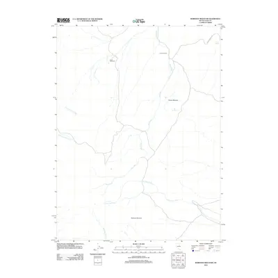
2012 Map of Robinson Mountain
USGS Topo · Published 2012About this map
High-desert ranching and the complex hydrology of Elko County define this landscape at the headwaters of several critical drainages. The Hackwood Ranch and Elliott High Ranch represent the human imprint on this territory, where land use is dictated by the availability of water from sources like Crane Springs and Rock Springs. The topography is dominated by the prominence of Robinson Mountain in the south and Squaw Mountain to the north, creating a rugged corridor for several branching waterways. Dixie Creek serves as a primary arterial, joined by tributaries including Little Porter Creek and Robinson Creek, while the northwestern reaches of the map are shaped by the South Fork Trout Creek and Dixie Fork Trout Creek. This 2012 survey illustrates the persistence of remote ranching operations in a basin-and-range environment where every canyon, such as Crane Springs Cyn, provides a vital conduit for seasonal runoff.
Find a feature on this map
12 named features on this map. Tap any name to fly to it.
Don’t see what you’re looking for? This feature index may not catch every label — zoom into the map to look around manually.
Map Details
Editions of this 2012 Robinson Mountain Map
This is the sole edition of this map. No revisions or reprints were ever made.
Other maps of this area

1934 · Jiggs
USGS Topo · 1:125,000

1937 · Jiggs
USGS Topo · 1:125,000

1952 · Dixie Flats
USGS Topo · 1:62,500

1952 · Pine Valley
USGS Topo · 1:62,500

1952 · Carlin
USGS Topo · 1:62,500

1955 · Winnemucca
USGS Topo · 1:250,000

1955 · Elko
USGS Topo · 1:250,000

1956 · Robinson Mtn
USGS Topo · 1:62,500

1958 · Winnemucca
USGS Topo · 1:250,000

1958 · Elko
USGS Topo · 1:250,000