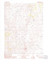
1985 Map of Robinson Mtn
USGS Topo · Published 1986About this map
Elliott High Ranch and Heckwood Ranch anchor this high-elevation landscape in Elko County, appearing during a period of ongoing livestock grazing and exploratory interest in the mid-1980s. The terrain is defined by the sharp elevations of the Pine Range, where Robinson Mountain and Squaw Mountain dominate the eastern horizons. Numerous unnamed springs dot the map, feeding water systems like Dixie Creek and Little Porter Creek, which illustrate the critical role of water management in this arid environment.
Find a feature on this map
13 named features on this map. Tap any name to fly to it.
Don’t see what you’re looking for? This feature index may not catch every label — zoom into the map to look around manually.
Map Details
Editions of this 1985 Robinson Mtn Map
This is the sole edition of this map. No revisions or reprints were ever made.
Other maps of this area

1934 · Jiggs
USGS Topo · 1:125,000

1937 · Jiggs
USGS Topo · 1:125,000

1952 · Dixie Flats
USGS Topo · 1:62,500

1952 · Pine Valley
USGS Topo · 1:62,500

1952 · Carlin
USGS Topo · 1:62,500

1955 · Winnemucca
USGS Topo · 1:250,000

1955 · Elko
USGS Topo · 1:250,000

1956 · Robinson Mtn
USGS Topo · 1:62,500

1958 · Winnemucca
USGS Topo · 1:250,000

1958 · Elko
USGS Topo · 1:250,000