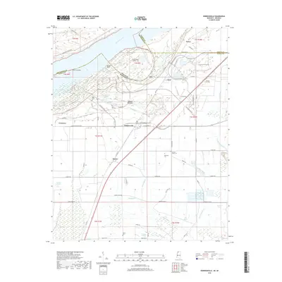
2018 Map of Robinsonville
USGS Topo · Published 2018About this map
Tunica Resorts and the surrounding alluvial plains of the Yazoo-Mississippi Delta define this area, where the Mississippi River once carved a winding path. The landscape is a complex network of remnant waterways and modern infrastructure, featuring Old River Lake and Fish Lake Bayou as evidence of the river's historical shifts. A high concentration of rural burial grounds, such as Saint Peters Cem and Johnson Chapel Cem, are scattered across the terrain near settlements like Robinsonville and Bowdre. The transformation of the riverfront is evident in the development of the Casino Strip Resort Blvd and Grand Casino Pkwy N, which now dominate the riverward side of the Mississippi River Levee near the historical landing at Commerce.
Find a feature on this map
75 named features on this map. Tap any name to fly to it.
Don’t see what you’re looking for? This feature index may not catch every label — zoom into the map to look around manually.
Map Details
Editions of this 2018 Robinsonville Map
This is the sole edition of this map. No revisions or reprints were ever made.
Other maps of this area

1908 · Hollywood
USGS Topo · 1:24,000

1908 · Lake Cormorant
USGS Topo · 1:24,000

1912 · Lake Cormorant
USGS Topo · 1:31,680

1913 · Hollywood
USGS Topo · 1:31,680

1931 · Horseshoe Lake
USGS Topo · 1:62,500

1932 · Horn Lake
USGS Topo · 1:48,000

1932 · Crenshaw
USGS Topo · 1:62,500

1935 · Crenshaw
USGS Topo · 1:62,500

1935 · Horn Lake
USGS Topo · 1:62,500

1939 · Clayton
USGS Topo · 1:62,500