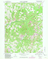
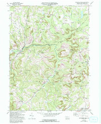
1968 Map of Rochester Mills
USGS Topo · Published 1981About this map
Little Mahoning Creek and its many tributaries, including Hess Run, Broadhead Run, and Straight Run, carve through this section of northern Indiana County. The 1968 landscape is defined by a dense network of energy extraction, where numerous Gas Wells and Oil Wells dot the hillsides alongside extensive Strip Mine operations. In several areas, such as near Canoe Ridge, these mines are marked as Strip Mine Reclaimed, showing the early efforts of land restoration in the region's coal country.
Find a feature on this map
54 named features on this map. Tap any name to fly to it.
Don’t see what you’re looking for? This feature index may not catch every label — zoom into the map to look around manually.
Map Details
Editions of this 1968 Rochester Mills Map
5 editions found
Other maps of this area

1902 · Indiana
USGS Topo · 1:62,500

1902 · Barnesboro
USGS Topo · 1:62,500

1904 · Barnesboro
USGS Topo · 1:62,500

1906 · Punxsutawney
USGS Topo · 1:62,500

1909 · Smicksburg
USGS Topo · 1:62,500

1938 · Smicksburg
USGS Topo · 1:62,500

1939 · Smicksburg
USGS Topo · 1:62,500

1939 · Punxsutawney
USGS Topo · 1:62,500

1942 · Punxsutawney
USGS Topo · 1:62,500

1943 · Punxsutawney
USGS Topo · 1:125,000
Featured Places
- Banks Township, PA
- North Mahoning Township, PA
- Nashville, Grant Township
- Gorman Summit, Montgomery Township
- Wilgus, Montgomery Township