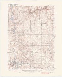
1939 Map of Rochester
USGS Topo · Published 1939About this map
Rochester sits as a regional hub in the late 1930s, anchored by the expansive grounds of the Rochester State Hospital and the Fair Grounds to the south. The city is a nexus for the C & NW railroad, which facilitates local industry and connects smaller outlying settlements like Chester and Viola. North of the city, the landscape is defined by the winding course of the Zumbro River and the significant reservoir of Lake Zumbro, where the Power House and landmarks like Rattlesnake Pt mark the transition into more varied terrain.
Find a feature on this map
74 named features on this map. Tap any name to fly to it.
Don’t see what you’re looking for? This feature index may not catch every label — zoom into the map to look around manually.
Map Details
Editions of this 1939 Rochester Map
4 editions found
Other maps of this area

1932 · Wabasha
USGS Topo · 1:62,500

1934 · Plainview
USGS Topo · 1:62,500

1935 · Rochester
USGS Topo · 1:48,000

1938 · Plainview
USGS Topo · 1:62,500

1939 · Rochester
USGS Topo · 1:62,500

1951 · Wabasha
USGS Topo · 1:62,500

1951 · Lake City
USGS Topo · 1:62,500

1953 · Saint Paul
USGS Topo · 1:250,000

1954 · Chatfield
USGS Topo · 1:62,500

1954 · Mason City
USGS Topo · 1:250,000