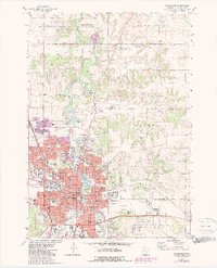
1972 Map of Rochester
USGS Topo · Published 1979About this map
The city of Rochester is the clear centerpiece of this 1970s landscape, illustrating a period of significant urban expansion and institutional growth. The map highlights the extensive medical and educational infrastructure that has come to define the region, including the world-renowned Mayo Clinic, the Rochester State Hospital, and the Olmsted Community Hospital. Educational institutions are dense throughout the city, ranging from local anchors like Marshall High School to the Rochester State Junior College.
Find a feature on this map
66 named features on this map. Tap any name to fly to it.
Don’t see what you’re looking for? This feature index may not catch every label — zoom into the map to look around manually.
Map Details
Editions of this 1972 Rochester Map
4 editions found
Other maps of this area

1935 · Rochester
USGS Topo · 1:48,000

1939 · Rochester
USGS Topo · 1:62,500

1953 · Saint Paul
USGS Topo · 1:250,000

1954 · Mason City
USGS Topo · 1:250,000

1955 · Stewartville
USGS Topo · 1:62,500

1955 · High Forest
USGS Topo · 1:62,500

1957 · Mason City
USGS Topo · 1:250,000

1958 · Mason City
USGS Topo · 1:250,000

1959 · Saint Paul
USGS Topo · 1:250,000

1965 · Oronoco
USGS Topo · 1:24,000