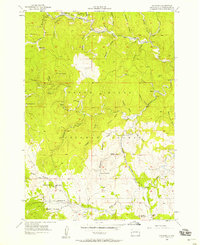
1956 Map of Rochford
USGS Topo · Published 1958About this map
The rugged gulches and mining history of Pennington County are meticulously detailed in this mid-century study of the Black Hills National Forest. Settlement patterns follow the winding tracks of the Chicago Burlington and Quincy railroad, which threads through the narrow valleys of Rapid Creek and Slate Creek. Local industry and community life are grounded in landmarks such as the Standby Mine near Rochford, the Lookout Mill, and the Cuttys Ark Mine.
Find a feature on this map
48 named features on this map. Tap any name to fly to it.
Don’t see what you’re looking for? This feature index may not catch every label — zoom into the map to look around manually.
Map Details
Editions of this 1956 Rochford Map
4 editions found
Other maps of this area

1894 · Deadwood
USGS Topo · 1:125,000

1896 · Harney Peak
USGS Topo · 1:125,000

1901 · Harney Peak
USGS Topo · 1:125,000

1901 · Deadwood
USGS Topo · 1:125,000

1916 · Deadwood
USGS Topo · 1:125,000

1953 · Nemo
USGS Topo · 1:24,000

1953 · Rapid City
USGS Topo · 1:250,000

1954 · Silver City
USGS Topo · 1:24,000

1954 · Hill City
USGS Topo · 1:24,000

1955 · Hot Springs
USGS Topo · 1:250,000