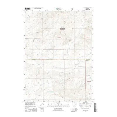
2015 Map of Rock Creek
USGS Topo · Published 2015About this map
Little Medicine sits at the southern edge of this high-plains landscape, where the headwaters of several river branches converge across the Converse Co Albany Co border. The map illustrates a complex drainage network, characterized by the N Fork Little Medicine Bow River and the S Fork Little Medicine Bow River carving through the terrain. To the north, the Medicine Bow National Forest covers the uplands, featuring landmarks like Breakneck Hill and the seasonal waters of Whiskey Springs. The settlement pattern is defined by remote rural roads like Little Medicine Rd and Balsh Rd, which follow the natural contours of the land. Small water bodies and crossings, such as Little Medicine Falls and the various prongs of Rock Cr, highlight the importance of water management in this Wyoming ranching and forest country.
Find a feature on this map
32 named features on this map. Tap any name to fly to it.
Don’t see what you’re looking for? This feature index may not catch every label — zoom into the map to look around manually.
Map Details
Editions of this 2015 Rock Creek Map
This is the sole edition of this map. No revisions or reprints were ever made.
Other maps of this area

1954 · Torrington
USGS Topo · 1:250,000

1955 · Casper
USGS Topo · 1:250,000

1958 · Casper
USGS Topo · 1:250,000

1958 · Torrington
USGS Topo · 1:250,000

1959 · Squaw Spring
USGS Topo · 1:24,000

1959 · Chalk Hills
USGS Topo · 1:24,000

1960 · Reno Hill
USGS Topo · 1:24,000

1962 · Casper
USGS Topo · 1:250,000

1964 · Buck Peak
USGS Topo · 1:24,000

1964 · Buffalo Peak
USGS Topo · 1:24,000