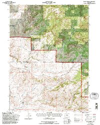
1992 Map of Rock Creek
USGS Topo · Published 1996About this map
Medicine Bow National Forest encompasses the northern half of this terrain, where the high-altitude landscape is defined by the complex drainage of the Little Medicine Bow River. The map captures a high-country ranching and forest environment at the boundary of Converse and Albany Counties during the early 1990s. Remote outposts like Russells Camp and distinct landmarks such as The Peach Orchard Spring provide focal points for local history and genealogy. A sparse but essential network of mountain transit lines, including the Breakneck Hwy and Medicine Bow River Road, follows the natural contours of the land, connecting disparate springs and creeks like Whiskey Springs and Sleepy Rock Creek. The presence of numerous benchmarks, such as BM 7406, highlights the precision of this U.S. Forest Service and USGS collaboration in mapping the high-altitude headwaters of the region.
Find a feature on this map
37 named features on this map. Tap any name to fly to it.
Don’t see what you’re looking for? This feature index may not catch every label — zoom into the map to look around manually.
Map Details
Editions of this 1992 Rock Creek Map
This is the sole edition of this map. No revisions or reprints were ever made.
Other maps of this area

1954 · Torrington
USGS Topo · 1:250,000

1955 · Casper
USGS Topo · 1:250,000

1958 · Casper
USGS Topo · 1:250,000

1958 · Torrington
USGS Topo · 1:250,000

1959 · Squaw Spring
USGS Topo · 1:24,000

1959 · Chalk Hills
USGS Topo · 1:24,000

1960 · Reno Hill
USGS Topo · 1:24,000

1962 · Casper
USGS Topo · 1:250,000

1964 · Buck Peak
USGS Topo · 1:24,000

1964 · Buffalo Peak
USGS Topo · 1:24,000