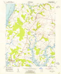
1953 Map of Rock Hall
USGS Topo · Published 1955About this map
Chesapeake Bay waterfront and the intricate tidal reaches of Kent County define this mid-century survey. The landscape is characterized by its agricultural interior, marked by features like the Wheat Bins near Asbury Ch, and its deep connection to the water. Small crossroads communities and landings such as Edesville, Fairlee, and Shipyard Landing serve as local hubs, while the shoreline is dotted with named points and coves including Whale Pt and Graveyard Cove. To the west, Tolchester Beach stands as a prominent coastal landmark overlooking the Chesapeake Bay. The map reveals a high density of rural religious life and genealogy markers, with Wesley Chapel, St Pauls Ch, and several associated burial grounds like Hadaway Chapel Cem providing a clear record of local settlement patterns during the 1950s.
Find a feature on this map
65 named features on this map. Tap any name to fly to it.
Don’t see what you’re looking for? This feature index may not catch every label — zoom into the map to look around manually.
Map Details
Editions of this 1953 Rock Hall Map
3 editions found
Other maps of this area

1893 · North Point
USGS Topo · 1:62,500

1893 · Gunpowder
USGS Topo · 1:62,500

1898 · Tolchester
USGS Topo · 1:125,000

1900 · Betterton
USGS Topo · 1:62,500

1901 · Chestertown
USGS Topo · 1:62,500

1901 · Gunpowder
USGS Topo · 1:62,500

1903 · Tolchester
USGS Topo · 1:125,000

1904 · North Point
USGS Topo · 1:62,500

1908 · Tolchester
USGS Topo · 1:125,000

1920 · Chestertown
USGS Topo · 1:62,500