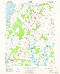
1953 Map of Rock Hall
USGS Topo · Published 1971About this map
Rock Hall and its surrounding Chesapeake tidewater landscape are documented here as they appeared in the early 1950s. This survey highlights the deep maritime connections of Kent County, tracing the intricate shoreline from the Chesapeake Bay bluffs at Tolchester Beach to the sheltered waters of Rock Hall Harbor. The map reveals a rural economy centered on small crossroads settlements like Edesville, Fairlee, and Georgetown, while the extensive network of tidal inlets such as West Fork Langford Creek and Fairlee Creek underscores the historical importance of water-based transport and fishing.
Find a feature on this map
72 named features on this map. Tap any name to fly to it.
Don’t see what you’re looking for? This feature index may not catch every label — zoom into the map to look around manually.
Map Details
Editions of this 1953 Rock Hall Map
3 editions found
Other maps of this area

1893 · North Point
USGS Topo · 1:62,500

1893 · Gunpowder
USGS Topo · 1:62,500

1898 · Tolchester
USGS Topo · 1:125,000

1900 · Betterton
USGS Topo · 1:62,500

1901 · Chestertown
USGS Topo · 1:62,500

1901 · Gunpowder
USGS Topo · 1:62,500

1903 · Tolchester
USGS Topo · 1:125,000

1904 · North Point
USGS Topo · 1:62,500

1908 · Tolchester
USGS Topo · 1:125,000

1920 · Chestertown
USGS Topo · 1:62,500