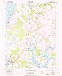
1953 Map of Rock Hall
USGS Topo · Published 1976About this map
The coastal village of Rock Hall serves as the focal point for this survey of Kent County, Maryland, where the tidal fingers of Chesapeake Bay meet the agricultural heart of the Eastern Shore. The landscape is defined by its deep relationship with the water, as seen in the numerous landings and coves like Shipyard Landing and Sinai Cove. Inland, the map reveals a mature network of crossroads and small settlements such as Edesville, Georgetown, and Sandy Bottom, each supported by community anchors including St Pauls Ch and Wesley Chapel. The presence of several grain storage sites like Wheat Bins and a Silo underscores the region's historical reliance on the local harvest. From the shoreline at Tolchester Beach to the winding course of Langford Creek, this record captures the rural character and maritime infrastructure of the peninsula during the mid-20th century.
Find a feature on this map
65 named features on this map. Tap any name to fly to it.
Don’t see what you’re looking for? This feature index may not catch every label — zoom into the map to look around manually.
Map Details
Editions of this 1953 Rock Hall Map
3 editions found
Other maps of this area

1893 · North Point
USGS Topo · 1:62,500

1893 · Gunpowder
USGS Topo · 1:62,500

1898 · Tolchester
USGS Topo · 1:125,000

1900 · Betterton
USGS Topo · 1:62,500

1901 · Chestertown
USGS Topo · 1:62,500

1901 · Gunpowder
USGS Topo · 1:62,500

1903 · Tolchester
USGS Topo · 1:125,000

1904 · North Point
USGS Topo · 1:62,500

1908 · Tolchester
USGS Topo · 1:125,000

1920 · Chestertown
USGS Topo · 1:62,500