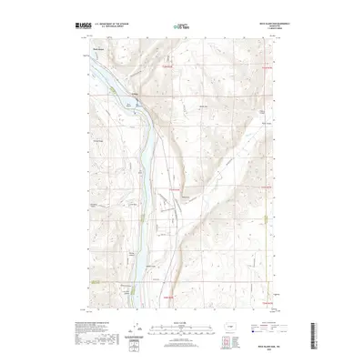
2020 Map of Rock Island Dam
USGS Topo · Published 2020About this map
Rock Island Dam anchors this landscape where the Columbia River cuts through the dramatic coulee country of central Washington. The topography is defined by sharp elevation changes, from the river's edge up to Badger Mtn and across the high plateaus of Jumpoff Ridge. The settlement of Voltage sits near the dam, reflecting the industrial development that reshaped the river into the Rock Island Pool. Local geography is etched with numerous deep drainages including Francis Canyon, Moses Coulee, and Lone Pine Canyon. This map details a complex network of orchards and access roads like Columbia View Orchard Rd and Nelson Siding Rd, illustrating the intersection of hydro-electric infrastructure and the region's agricultural footprint. Notable landmarks such as Lone Rock and Rocky Point provide clear reference points for those studying the rugged terrain of the Douglas County and Chelan County borders.
Find a feature on this map
46 named features on this map. Tap any name to fly to it.
Don’t see what you’re looking for? This feature index may not catch every label — zoom into the map to look around manually.
Map Details
Editions of this 2020 Rock Island Dam Map
This is the sole edition of this map. No revisions or reprints were ever made.
Other maps of this area

1909 · Quincy
USGS Topo · 1:62,500

1910 · Quincy
USGS Topo · 1:62,500

1912 · Malaga
USGS Topo · 1:48,000

1914 · Malaga
USGS Topo · 1:62,500

1920 · Colockum Pass
USGS Topo · 1:125,000

1922 · Colockum Pass
USGS Topo · 1:125,000

1953 · Ritzville
USGS Topo · 1:250,000

1957 · Wenatchee
USGS Topo · 1:250,000

1959 · Ritzville
USGS Topo · 1:250,000

1965 · Ritzville
USGS Topo · 1:250,000