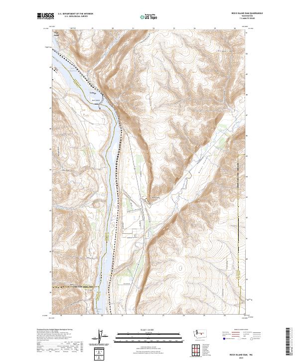
2023 Map of Rock Island Dam
USGS Topo · Published 2023About this map
The Rock Island Dam anchors this stretch of the Columbia River, where the waters of the Rock Island Pool give way to Wanapum Lake. The terrain is defined by dramatic elevation changes, from the heights of Badger Mtn and Jumpoff Ridge down to the carved depths of Moses Coulee and Francis Canyon. The small settlements of Rock Island and Voltage sit along the river's edge, connected by a network of steep grades and local roads such as Battermann Rd and Rock Island Grade SW. In the southwest, the Colockum Game Range spans a landscape of named drainages including Whitson Canyon and Lone Pine Canyon. This 2023 survey illustrates the complex boundary where Douglas, Chelan, Kittitas, and Grant counties meet, highlighting a region where infrastructure and geography are closely intertwined.
Find a feature on this map
47 named features on this map. Tap any name to fly to it.
Don’t see what you’re looking for? This feature index may not catch every label — zoom into the map to look around manually.
Map Details
Editions of this 2023 Rock Island Dam Map
This is the sole edition of this map. No revisions or reprints were ever made.
Other maps of this area

1909 · Quincy
USGS Topo · 1:62,500

1910 · Quincy
USGS Topo · 1:62,500

1912 · Malaga
USGS Topo · 1:48,000

1914 · Malaga
USGS Topo · 1:62,500

1920 · Colockum Pass
USGS Topo · 1:125,000

1922 · Colockum Pass
USGS Topo · 1:125,000

1953 · Ritzville
USGS Topo · 1:250,000

1957 · Wenatchee
USGS Topo · 1:250,000

1959 · Ritzville
USGS Topo · 1:250,000

1965 · Ritzville
USGS Topo · 1:250,000