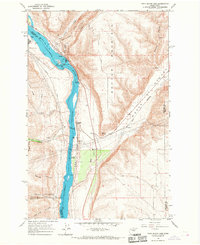
1966 Map of Rock Island Dam
USGS Topo · Published 1968About this map
Rock Island Dam stands as the central engineering marvel of this mid-1960s survey, anchoring the Columbia River between Chelan and Douglas counties. This industrial corridor is defined by the massive infrastructure required for hydroelectric power, including a Powerhouse, a Fish Ladder, and specialized installations like the Valhala Substation and Columbia Substation. The settlement of Voltage sits adjacent to the dam, while the Great Northern railroad tracks follow the eastern bank, passing through the small siding of Bonspur. Away from the river, the landscape shifts abruptly to the dramatic geology of Badger Mountain and the deep trench of Moses Coulee. Land use is further delineated by the Rock Island State Park and the Colockum Game Range Headquarters to the south, highlighting a region balanced between heavy utility production and conservation.
Find a feature on this map
33 named features on this map. Tap any name to fly to it.
Don’t see what you’re looking for? This feature index may not catch every label — zoom into the map to look around manually.
Map Details
Editions of this 1966 Rock Island Dam Map
This is the sole edition of this map. No revisions or reprints were ever made.
Other maps of this area

1909 · Quincy
USGS Topo · 1:62,500

1910 · Quincy
USGS Topo · 1:62,500

1912 · Malaga
USGS Topo · 1:48,000

1914 · Malaga
USGS Topo · 1:62,500

1920 · Colockum Pass
USGS Topo · 1:125,000

1922 · Colockum Pass
USGS Topo · 1:125,000

1953 · Ritzville
USGS Topo · 1:250,000

1957 · Wenatchee
USGS Topo · 1:250,000

1959 · Ritzville
USGS Topo · 1:250,000

1965 · Ritzville
USGS Topo · 1:250,000