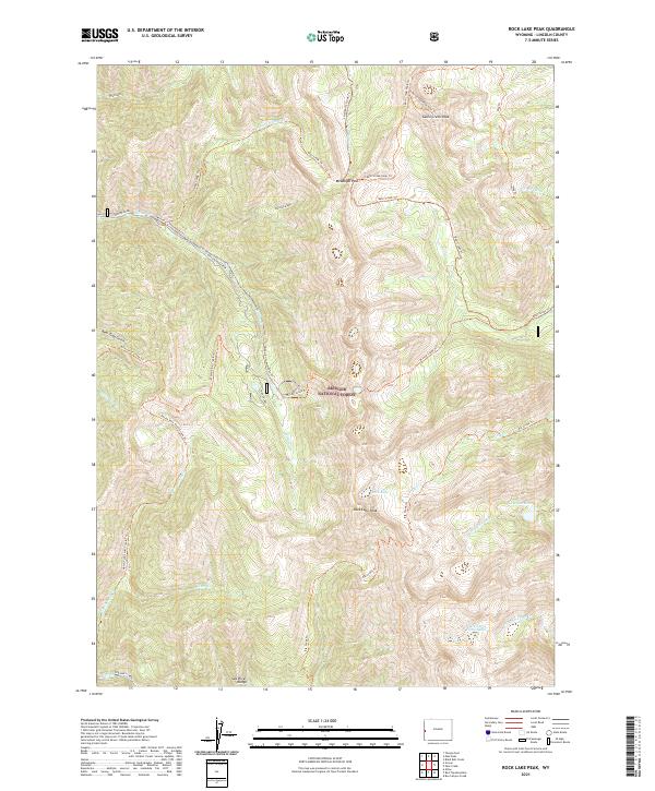
2021 Map of Rock Lake Peak
USGS Topo · Published 2021About this map
Rock Lake Peak and the high ridges of the Salt River Range dominate this 2021 survey of the Bridger National Forest in Lincoln County. The landscape is defined by its deep alpine canyons and a complex network of seasonal watercourses and remote high-altitude basins. Significant hydrographic features such as Rock Lake, Lake Barstow, and Hidden Lake are gathered near the crests, feeding the headwaters of Elk Creek and the South Three Forks Lakes.
Find a feature on this map
39 named features on this map. Tap any name to fly to it.
Don’t see what you’re looking for? This feature index may not catch every label — zoom into the map to look around manually.
Map Details
Editions of this 2021 Rock Lake Peak Map
This is the sole edition of this map. No revisions or reprints were ever made.
Other maps of this area

1921 · Afton
USGS Topo · 1:125,000

1955 · Preston
USGS Topo · 1:250,000

1958 · Preston
USGS Topo · 1:250,000

1962 · Preston
USGS Topo · 1:250,000
1980 · Blind Bull Creek
USGS Topo · 1:24,000
1980 · Grover
USGS Topo · 1:24,000
1980 · Man Peak
USGS Topo · 1:24,000
1980 · Box Canyon Creek
USGS Topo · 1:24,000
1980 · Red Top Mountain
USGS Topo · 1:24,000
1980 · Park Creek
USGS Topo · 1:24,000