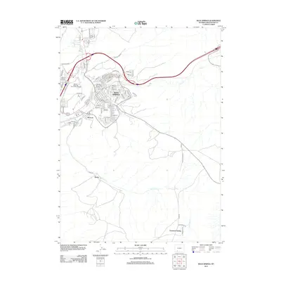
2012 Map of Rock Springs
USGS Topo · Published 2012About this map
Rock Springs stands at the center of this 2012 landscape, where the urban grid is defined by the convergence of Killpecker Cr and Bitter Cr. The map captures the city's modern layout, including the campus of Western Wyoming Community College and residential developments stretching toward the hills. To the south and west, the terrain transitions into the more open spaces of the high desert, marked by the courses of Sweetwater Cr and the smaller settlements of Blairtown and Quealy. This document provides a clear view of the transportation corridors that have long dictated the growth of the region, from the heavy influence of the Railroad Ave corridor to the arterial roads connecting outlying areas like Arrowhead Springs. Genealogists and local historians will find the exact location of Mountain View Cem particularly useful for tracing family roots in the Sweetwater County area.
Find a feature on this map
77 named features on this map. Tap any name to fly to it.
Don’t see what you’re looking for? This feature index may not catch every label — zoom into the map to look around manually.
Map Details
Editions of this 2012 Rock Springs Map
This is the sole edition of this map. No revisions or reprints were ever made.
Other maps of this area

1908 · Rock Springs
USGS Topo · 1:62,500

1910 · Rock Springs
USGS Topo · 1:62,500

1954 · Rock Springs
USGS Topo · 1:250,000

1957 · Firehole Basin
USGS Topo · 1:62,500

1958 · Rock Springs
USGS Topo · 1:250,000

1961 · Pilot Butte
USGS Topo · 1:24,000

1961 · Kanda
USGS Topo · 1:24,000

1962 · Rock Springs
USGS Topo · 1:250,000

1966 · Firehole Basin
USGS Topo · 1:62,500

1968 · North Baxter
USGS Topo · 1:24,000