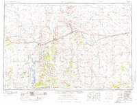
1954 Map of Rock Springs
USGS Topo · Published 1976About this map
Rock Springs and the surrounding high desert of southwestern Wyoming are documented here during a period of mid-century infrastructure expansion. The Union Pacific railroad and U S 30 serve as the primary east-west corridor, cutting through the Red Desert Basin and crossing the Continental Divide. This landscape is defined by its widely dispersed ranching outposts, such as the Erickson Kent Ranch, Pio Moses Ranch, and Eversole Ranch, which represent the enduring pastoral economy of the era. To the west, the Green River carves through the terrain near the Devils Playground, while prominent landmarks like Pilot Butte and White Mountain provided essential orientation for early travelers. The presence of numerous Gas wells and the CAA Building near Bitter Creek highlights the concurrent growth of the region's energy sector and aviation communications.
Find a feature on this map
75 named features on this map. Tap any name to fly to it.
Don’t see what you’re looking for? This feature index may not catch every label — zoom into the map to look around manually.
Map Details
Editions of this 1954 Rock Springs Map
2 editions found

Other maps of this area

1885 · Ashley
USGS Topo · 1:250,000

1885 · Uinta
USGS Topo · 1:250,000

1905 · Gilbert Peak
USGS Topo · 1:125,000

1906 · Gilbert Peak
USGS Topo · 1:125,000

1906 · Marsh Peak
USGS Topo · 1:125,000

1908 · Marsh Peak
USGS Topo · 1:125,000

1908 · Rock Springs
USGS Topo · 1:62,500

1910 · Rock Springs
USGS Topo · 1:62,500

1916 · Craig
USGS Topo · 1:125,000

1952 · Willow Creek Butte
USGS Topo · 1:24,000