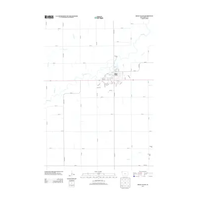
2013 Map of Rock Valley
USGS Topo · Published 2013About this map
Rock Valley serves as the focal point of this Sioux County landscape, situated along a prominent bend of the Rock River. The map illustrates a well-defined grid of agricultural roads, including Dogwood Ave and Eagle Ave, which connect the town to the surrounding countryside. In the rural sections to the southeast, local industry is marked by dairy operations such as Rozeboom Dairy, Lonesome Pine Dairy, and Renes Dairy, highlighting the importance of the dairy economy in northwest Iowa. Public recreation is represented at the Rock River Access north of town, where the river meets the mouth of Rogg Cr. The geography is further defined by several minor waterways like Dry Run Cr and Dry Cr, which cut through the level terrain and dictate the placement of field boundaries and farmstead approaches.
Find a feature on this map
64 named features on this map. Tap any name to fly to it.
Don’t see what you’re looking for? This feature index may not catch every label — zoom into the map to look around manually.
Map Details
Editions of this 2013 Rock Valley Map
This is the sole edition of this map. No revisions or reprints were ever made.
Other maps of this area

1955 · Sioux Falls
USGS Topo · 1:250,000

1958 · Sioux Falls
USGS Topo · 1:250,000

1964 · Sioux Center
USGS Topo · 1:24,000

1964 · Hull
USGS Topo · 1:24,000
1968 · Hawarden North
USGS Topo · 1:24,000

1968 · Fairview
USGS Topo · 1:24,000

1968 · Labanon
USGS Topo · 1:24,000
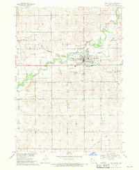
1968 · Rock Valley
USGS Topo · 1:24,000
1971 · Inwood
USGS Topo · 1:24,000

1971 · Doon
USGS Topo · 1:24,000