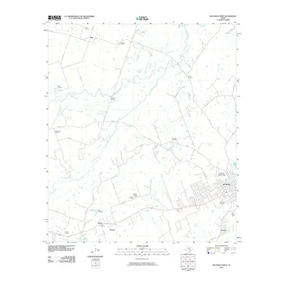
2010 Map of Rockdale West
USGS Topo · Published 2010About this map
Rockdale serves as the focal point of this Milam County landscape, showing its residential and industrial layout as it appeared in the early 21st century. The map reveals a dense network of rural cemeteries that speak to the long-standing family lineages and community organizations of the region, including the International Order of Odd Fellows Cemetery, the Garza Family Cemetery, and the Murray Cemetery. Water features like the winding San Gabriel River and its various tributaries, such as Alligator Creek and Brushy Slough, dictate the topography of the outlying agricultural land. Small rural settlements like Tracy, Marjorie, and Praesel are documented along the country roads and rail corridors. For those studying local recreation and infrastructure, the inclusion of the Fair Park Racetrack and Voss Lake Dam provides specific evidence of community development outside the city center.
Find a feature on this map
55 named features on this map. Tap any name to fly to it.
Don’t see what you’re looking for? This feature index may not catch every label — zoom into the map to look around manually.
Map Details
Editions of this 2010 Rockdale West Map
This is the sole edition of this map. No revisions or reprints were ever made.
Other maps of this area

1885 · Taylor
USGS Topo · 1:125,000

1887 · Taylor
USGS Topo · 1:125,000

1894 · Taylor
USGS Topo · 1:125,000

1910 · Buckholts
USGS Topo · 1:24,000

1912 · Buckholts
USGS Topo · 1:31,680

1954 · Austin
USGS Topo · 1:250,000

1956 · Milano
USGS Topo · 1:62,500

1961 · Cameron
USGS Topo · 1:24,000

1961 · Rockdale East
USGS Topo · 1:24,000

1962 · Rockdale West
USGS Topo · 1:24,000