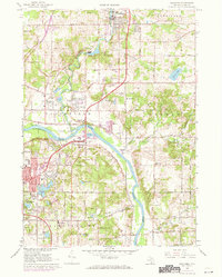
1967 Map of Rockford
USGS Topo · Published 1973About this map
The Grand River and Rogue River converge in this northern Kent County landscape, defining the layout of mid-century communities like Rockford, Belmont, and Childsdale. The Penn Central railroad corridor follows the valley floor, passing the Gaging Station and the water-powered legacy of the riverfront. While the area shows signs of post-war suburbanization, such as the Blythefield Country Club and a large Shopping Center on the southern edge, it remains anchored by traditional landmarks like Plainfield Cem and Oakwood Cem. Institutional growth is evident through numerous local schools, including Richardson Sch and Forest Valley Sch, while the expansive Cannon State Game Area preserves the wild character of the eastern hills. Numerous gravel pits and oil wells scattered across the townships of Algoma and Plainfield indicate the active extraction economy alongside the developing residential subdivisions.
Find a feature on this map
65 named features on this map. Tap any name to fly to it.
Don’t see what you’re looking for? This feature index may not catch every label — zoom into the map to look around manually.
Map Details
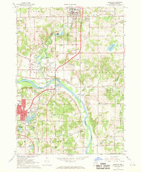
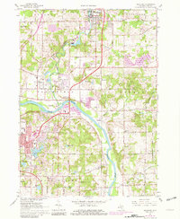
Editions of this 1967 Rockford Map
3 editions found
Other maps of this area

1914 · Grand Rapids
USGS Topo · 1:62,500

1918 · Cedar Springs
USGS Topo · 1:62,500

1918 · Lowell
USGS Topo · 1:62,500

1943 · Cedar Springs
USGS Topo · 1:62,500

1943 · Grand Rapids
USGS Topo · 1:62,500

1943 · Lowell
USGS Topo · 1:62,500

1954 · Midland
USGS Topo · 1:250,000

1958 · Midland
USGS Topo · 1:250,000

1958 · Grand Rapids
USGS Topo · 1:250,000

1959 · Midland
USGS Topo · 1:250,000