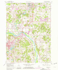
1967 Map of Rockford
USGS Topo · Published 1982About this map
The Grand River and Rogue River converge at the heart of this landscape, defining the residential and industrial growth of the Plainfield and Cannon townships. Rockford serves as a primary northern anchor, where the Pennsylvania railroad tracks parallel the river valley. The map reveals a suburbanizing terrain during the late 1960s, marked by the emergence of the Northview High School and a Shopping Center near East Oakview, while older rural elements like the Mason Cem and numerous Gravel Pits persist. Recreation is a significant theme on the eastern edge, with Ski Lifts appearing near the Cannonsburg State Game Area. The transition from river-bottom agriculture to residential development is evident in the clusters of schools and churches, including Northland Ch and Crestwood Sch, that serve these growing communities north of Grand Rapids.
Find a feature on this map
72 named features on this map. Tap any name to fly to it.
Don’t see what you’re looking for? This feature index may not catch every label — zoom into the map to look around manually.
Map Details
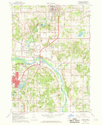
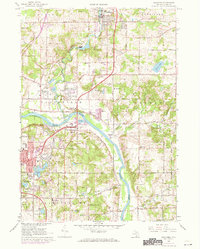
Editions of this 1967 Rockford Map
3 editions found
Other maps of this area

1914 · Grand Rapids
USGS Topo · 1:62,500

1918 · Cedar Springs
USGS Topo · 1:62,500

1918 · Lowell
USGS Topo · 1:62,500

1943 · Cedar Springs
USGS Topo · 1:62,500

1943 · Grand Rapids
USGS Topo · 1:62,500

1943 · Lowell
USGS Topo · 1:62,500

1954 · Midland
USGS Topo · 1:250,000

1958 · Midland
USGS Topo · 1:250,000

1958 · Grand Rapids
USGS Topo · 1:250,000

1959 · Midland
USGS Topo · 1:250,000